Integrating GIS data
Introduction
Buzzy takes Location Intelligence on the road with your entire organization via reusable apps and rapid mobile app building.It makes it easy to supercharge business processes with location enriched data and insight.
With Buzzy, you can use data from different databases and file formats. It’s easy to integrate and orchestrate this data to quickly gain a richer, more complete view of spatial opportunities and risks from location analytics. After ingestion, spatial data can be managed centrally, enabling you to determine the data you need and then combine it for a robust, single, location-intelligent view.
MapInfo Professional is a desktop GIS solution used for creating, editing, visualizing and analyzing customer and business data in the context of location.
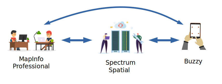
GIS data that has been captured in MapInfo Professional can be shared throughout an enterprise or consituency. This is done by copying and/or importing data into shared databases available in Buzzy. There are two scenarios for making the data captured in MapInfo Professional available for mobile access:
- Copy Mapinfo Tab files or use an spatial enabled RDBMS and register this data with Spectrum Spatial using the map uploader. This data is then available to Connect for integration into mobile applications.
- Export/transform the MapInfo Table file into a CSV or GeoJSON file. Then import this text file into Buzzy.
map uploader
Create a named connection in Spatial Manager, if not created already. Refer to the Spectrum Spatial documentation on how to create a connection.
Prepare and copy the data (tab files) into the repository. Based on the connection path, copy the data in the same location. Note that this is not required if an RDBMS is used.
Install the latest version Map Uploader, if already not installed: Download the Spectrum Spatial Map Uploader tool from Spectrum home page. Launch MapInfo Pro and navigate to Home tab > Tool Extensions> Options> to add the Map Uploader tool. The tool should be now added under the registered tools.
Upload the data using the Map Uploader. In MapInfo Pro, launch the tool Map Uploader. Click on Sign in. From the drop down list, select the map to be uploaded and click on Upload Map. Select the Map Repository location. Either select any folder present within the NamedLayers or create a new folder under ‘NamedLayers’. There is a button for creating a new folder (See the button with the plus sign within the little square located under the text ‘select map repository location’). In this step, the map can be renamed. Select Continue. Map uploader checks to see if the data is present in the repository and would prompt if it has successfully found the data. Then click on Upload - A success message is shown if the map has been uploaded correctly with a link to view map in Spatial Manager.
The Layers are now available for Buzzy. Please refer to the Advanced Map document Adding Spectrum Spatial data to maps.
export / import
In this scenario, MapInfo Professional and Buzzy are not attached in any way. Data is exported and imported using the capabilities of MapInfo Professional and Buzzy. A common file format is required to share the data:
- Comma Separated Value (CSV) text file for points
- GeoJSON text file for points, lines and polygons
The article Export MapInfo Professional CSV and Import into Buzzy describes the steps to accomplish this.