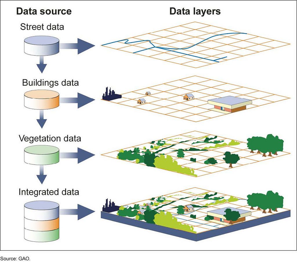
Vector Layers
Vector layers are a collection of real world features, like trees or roads. Features have attributes, which consist of text or numerical information. Features also have basic geometries consisting of three types:
- Points - single vertex.
- Lines - two or more vertices where the first and last vertex are not equal.
- Polygons - three or more vertices with the last vertex equal to the first.
Features in a vector layer have the the same geometry type and the same kinds of attributes.

The following are the types of vector layers you can add to an Advanced Map:
- Existing Microapp - An Application that has a Location Field
- Spectrum Spatial - An exising layer published on an instance of Spectrum Spatial
Existing App
The Location Field type is used to store feature geometry information in a Microapp. Buzzy will allow you to create and modify the geometry data in a Microapp. The Advanced Map displays this data as well as capture new data.
The Steps to associate a Microapp with an Advanced Map are:
- select Add Layer from the Map Layer Control
- choose data source existing app
- enter a few characters of your Buzz name and then select it.
- select your Microapp with the location Field
- select Add Layer
Spectrum Spatial
To add a Spectrum Spatial layer, you must first configure the server. The Advanced Map settings page allows you to enter server and credentials:
- Spectrum API Server - The URL for the spectrum server: https://server:port
- Spectrum API Login - The login name for the qualified user
- Spectrum API Password - The password for the qualified user
Once the credentials have been established, a layer can be added in the Settings / Layers tab by selecting Spectrum Spatial from the data source dropdown. Begin typing the name of the layer and then select it.
Layer Properties
Live Update
Live Update means the sharing of information to ensure data consistency between resources (mobile device and server) connected via the internet, to improve reliability, availability, fault-tolerance, and accessibility of data. In some situations where network connectivity is poor or massive database updates are taking place this should be turned off.
Allow Add Data
Allow data addition via map enables updates from the mobile device to the server. The type of geographic data capture should be specified as Point, Line or Polygon. See adding data for more information.
Show on initial load
Some layers may only be used in specific situations. This data does not always need to be rendered. For this case, the layer can be invisible when the map is initially drawn.
Fit Map
Setting the initial map extents based on the layer extents is useful when a user wishes to first load the map at a particular area of interest. THis should be used conscientiously, as only one layer should have this turned on; multiple layers may cause unexpected results.
Number of Rows
Number of rows sets the upper limit of the count of features displayed on the map for this layer.
Minimum and Maximum Zoom
The zoom extent (both maximum and minimum) is dictated by the basemap tiling scheme. These values specify the layer visibility at zoom levels. For example, values minimum 1 to maximum 3 defines the layer visibility as on for extents 1 to 3.