Tile Layers
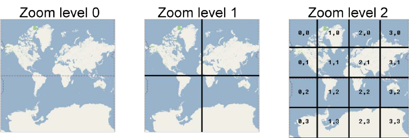
Tile layers are displayed by seamlessly joining requested images over the internet in the Advanced map. The map data is divided into gridded sections called tiles. Tiles are square images in various sizes which are available at different zoom levels. Each time the user pans, most of the tiles are still relevant, and can be kept displayed, while new tiles are fetched.
Raster tile layers are most appropriate for basemaps that give your maps geographic context, such as roadmap, satellite or weather.
URL Format
The de facto standard for tile server access is XYZ:
- An X and Y numbering scheme
- PNG images for tiles
- Images are served through a Web server, with a URL like http://…/Z/X/Y.png, where Z is the zoom level, and X and Y identify the tile.
For example, the following fun URLs can be specified:
https://stamen-tiles.a.ssl.fastly.net/watercolor/{z}/{x}/{y}.jpg
https://stamen-tiles.a.ssl.fastly.net/toner/{z}/{x}/{y}.png
https://stamen-tiles.a.ssl.fastly.net/terrain/{z}/{x}/{y}.jpg
Map tiles by Stamen Design.